MileHacker Logo
Getting Around Blue Ridge Parkway

Getting Around Blue Ridge Parkway

Blue Ridge Parkway North Carolina, USA Travel Guide

Public Transportation Overview

There is no public transportation system, like a metro, city buses, or trams, that operates on the Blue Ridge Parkway itself. The Parkway functions specifically as a scenic driving route for private vehicles and is under the management of the National Park Service, not a municipal transit authority.

Its winding nature, limited access points, and focus on leisure driving render it unsuitable for traditional public transit. Therefore, no route maps, hubs, ticketing systems, fare options, hours of operation, frequency, or accessibility information related to public transportation apply directly to the Parkway.

In Nearby Towns

  • Town Bus Systems: Larger towns adjacent to the Parkway, like Asheville, do have limited local public bus systems (e.g., ART - Asheville Redefines Transit).
  • Local Routes Only: These systems serve local city routes within the town limits and do not extend to the Parkway itself.
  • Parkway Access: If you are staying in a town like Asheville without a car, you would still need a car or other arranged transport to reach the Parkway.

Detailed Physical Map

A printed map (like National Geographic Trails Illustrated) is due to unreliable cell service.

Offline Digital Maps

Download maps for Google Maps or Apple Maps for the entire corridor before losing service.

Milepost System

Familiarize yourself with the Parkway's milepost system for orientation.

Efficient Parkway Navigation

Connectivity & Fuel
  • Cell Service: Anticipate large stretches with no signal; plan for communication interruptions.
  • Fuel Stops: No gas on the Parkway; plan to exit to nearby towns for refueling.
  • Leisurely Pace: The Parkway design supports leisurely driving; allow ample time for travel and stops.
Road Conditions & Wildlife
  • Road Conditions: Be aware of potential hazards like dense fog, wet leaves (in fall), and occasional wildlife.
  • Wildlife: Drive cautiously and anticipate sudden animal crossings, especially at dawn and dusk.
  • NPS Website: Check Nps.gov/blri for current road closures, especially in winter.

Taxis & Ride-Sharing on the Parkway

Availability & Fares

Taxis are in larger towns (Asheville, Boone, Cherokee). Ride-sharing (Uber, Lyft) in more populated towns. Fares vary by town and distance.

Safety

For taxis, use licensed services. For ride-sharing, verify driver and vehicle match app details. Share trip details for added safety.

Parkway Service Limitations

Not practical or widely available on the Parkway itself due to length, rural nature, and spotty cell service. Few drivers operate there.

No Direct Hail

Generally cannot hail on the street. Call local companies or find at designated stands (airports, major hotels).

Rental Options for Parkway Travel

Renting a car is the preferred and most effective way to explore the Blue Ridge Parkway. All major international car rental brands operate in the region.

Car Rental: Procedures & Requirements

  • Procedures: Book your rental car in advance, especially during peak seasons. Pick up at regional airports or major nearby towns.
  • Requirements: Valid driver's license (International Driving Permit for non-U.S. Licenses).
  • Major credit card in the renter's name.
  • Minimum Age: Typically 21, with potential surcharges for drivers under 25.

Other Rental Vehicles & Tips

  • Motorcycle Rentals: Available in larger towns near the Parkway (e.g., Asheville, Charlotte) from specialty dealers.
  • Bicycle Rentals: Available in towns like Asheville and Boone from local bike shops. No bicycle rental services directly on the Parkway.
  • Specialty Vehicle Options: No unique local transportation options like tuk-tuks or jeepneys. The main vehicle type is a standard passenger car, SUV, or motorcycle.
  • Sea/River Arrivals: Not directly relevant for accessing the Parkway, as it is located far inland.

Driving Laws & Road Conditions

  • Driving Laws: Standard U.S. Driving laws apply. Drive on the right side of the road.
  • Speed Limit: Generally 45 mph (72 km/h) or lower, strictly enforced. It is a scenic road for enjoyment.
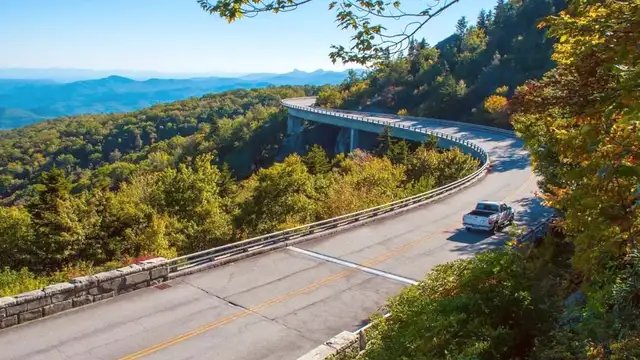
  • Road Conditions: Generally well-maintained, but it is a winding mountain road with curves, inclines, and declines.
  • Hazards: Be aware of dense fog, wet leaves (in fall), and occasional wildlife.
  • Parking Information: Abundant designated overlooks and parking areas are available directly off the Parkway. Parking is free.
  • Parking Rules: Only park in designated paved areas. Do not pull off onto the grass or block traffic lanes.

Departure Information

Exit Fees or Taxes

No specific exit fees or taxes apply for departing from the Blue Ridge Parkway itself. Standard U.S. Airport departure taxes are typically included in your airline ticket fare if flying out.

Departure Procedures & Timing

Allow ample time to drive from your accommodation to your chosen departure airport (Parkway speed limits are lower). For domestic flights, arrive 1.5-2 hours before departure; for international, 2.5-3 hours.

Airport Facilities

U.S. Airports offer a full range of facilities for departing travelers, including check-in counters, security screening, and various pre- and post-security dining and retail options.

Walking & Cycling the Parkway

The Blue Ridge Parkway delivers opportunities for walking and cycling, but with specific considerations due to its design as a motor vehicle parkway.

Pedestrian-Friendly Areas & Routes

  • Overlooks: Many overlooks have short, paved walking paths leading to scenic viewpoints, generally flat and accessible.
  • Visitor Centers: Often feature well-maintained paths and interpretive trails around their facilities.
  • Hiking Trails: Numerous official hiking trails are accessible directly from parking areas, ranging from easy, short loops to strenuous treks.
  • Self-Guided Options: Many Parkway guides and apps offer suggestions for self-guided walks at specific points of interest.

Bicycle Infrastructure & Safety

  • Shared Roadway: Cycling is permitted, but no dedicated bike lanes. Cyclists share the two-lane road with motor vehicles.
  • Challenges: Constant elevation changes, long climbs, steep descents, and numerous tunnels make it a challenging cycling route.
  • Visibility: Cyclists should use a bright bicycle light (front and rear) and wear reflective gear, especially in tunnels or low light conditions.
  • Helmets: Strongly recommended for all cyclists. Be prepared for varying road surfaces and potential fog.

No-Go Areas for Pedestrians & Cyclists

Tunnels

While permitted, walking or cycling through Parkway tunnels demands extreme caution due to darkness, vehicle traffic, and limited space. Use lights and reflective clothing.

High Caution

Roadway Shoulders

Do not walk or cycle directly on the narrow shoulders of the Parkway for extended periods. Utilize designated overlooks and trails for stopping and walking.

Avoid Shoulders

Unmarked Areas

Do not venture off-trail or into unmarked areas to preserve sensitive ecosystems and for your own safety.

Stay on Trail

Specialized Transportation

Tour Buses & Water Transport
  • Tour Buses: Organized tour buses operate for fall foliage tours or specific attractions. Book through private companies in nearby towns (e.g., Asheville). No formal "hop-on-hop-off" service.
  • Boat Taxis & Water Transport: Not applicable to the Blue Ridge Parkway. Lakes and rivers nearby are for recreation (rafting, kayaking), not transportation along the Parkway corridor.
  • Unique Local Transport: No cable cars or funiculars operate directly on the Parkway itself.
Accessibility Services
  • Accessible Overlooks: Many overlooks are paved and offer accessible parking and level viewing areas.
  • Visitor Centers: Modern visitor centers often have ramps and accessible restrooms.
  • Trail Information: Many hiking trails remain unpaved and challenging for wheelchair users. Check specific details on the NPS website before visiting.

Limitations for Access

  • Personal Vehicle is main: The Parkway's design and rural nature mean a private vehicle is the core method for exploration.
  • Cell Service: Unreliable along much of the route, impacting reliance on digital maps and ride-sharing services.
  • Fueling: No gas stations on the Parkway; requiring planned exits to nearby towns for refueling.
  • Weather Impact: Seasonal closures due to snow/ice significantly affect accessibility in winter months.
  • No Public Transit: Traditional public transportation does not operate directly on the Parkway itself.
  • Ride-Sharing Limitations: Not practical for general Parkway travel due to distances and service availability issues.
  • Always Check NPS: The official National Park Service website is the most reliable source for current road conditions and alerts.
  • Respect Natural Environment: Stay on marked trails and avoid disturbing wildlife or vegetation.

Final Local Transport Tip

Your personal vehicle is the fundamental mode of transport for experiencing the Blue Ridge Parkway. Public transit and ride-sharing services are not suitable for traversing this scenic route.

Always prioritize safety by grasping road conditions, carrying maps, and being aware of limited cell service throughout the Parkway.