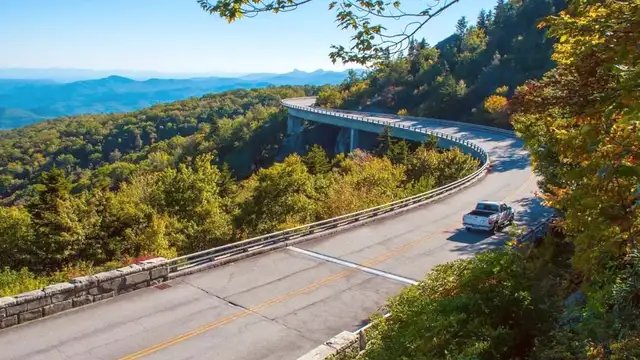
Blue Ridge Parkway North Carolina, USA Travel Guide
It is a place where every turn unveils a new vista, encouraging you to slow down, breathe deeply, and meet the enduring beauty of the Appalachian Mountains. This guide outlines an experience that blends scenic driving featuring outdoor exploration and cultural discovery, promising memories that last long after your trip concludes.
The Blue Ridge Parkway's origins are deeply rooted in American history, specifically the economic challenges of the Large Depression. Construction began in 1935 as a New Deal public works project under President Franklin D. Roosevelt's administration. The main aims were dual: to offer much-needed employment during a severe economic downturn and to make a scenic route connecting two main national parks – Shenandoah and the Great Smoky Mountains.
The Parkway was conceived not as a typical highway, but as a "parkway" – a design philosophy emphasizing leisurely scenic driving plus recreation over commercial traffic or speed. Its design principles focused on harmony with the natural landscape. Engineers and architects prioritized blending the road into its surroundings, employing local materials like stone for bridges, tunnels, and overlooks. This approach minimized visual impact and preserved the area's natural character.
This ambitious undertaking delivered jobs for thousands of workers, including many members of the Civilian Conservation Corps (CCC), a program that engaged young men in conservation and public lands projects. These workers performed strenuous tasks, from clearing land and building stone structures to planting trees, influencing the landscape you see today.
You will observe numerous stone arches, intricate dry-laid walls, and tunnels bored through solid rock, all reflecting this careful integration. The Park road is a living monument to American ingenuity, perseverance, and a deep respect for the natural environment. It remains a testament to what public works projects accomplish for both people and nature.
Finished in 1987, it was the final Parkway section.
Near Grandfather Mountain (Milepost 304.4).
Revolutionary cantilevered method, top-down construction.
Minimized disturbance to fragile slopes below.
Commitment to progress and safekeeping.
The National Park Service oversees the Parkway, maintaining its integrity as a recreational corridor rather than a commercial highway. This management upholds a consistent experience focused on natural beauty and outdoor access. As you travel, notice how the road flows with the contours of the land, evidence of its design philosophy.
Elevations along the North Carolina section vary considerably, ranging from about 1,000 feet (305 meters) near Cherokee, offering warmer, lower-mountain experiences, to over 6,000 feet (1,829 meters) at Richland Balsam (Milepost 431), the highest point on the entire Parkway. This dramatic elevation change accounts for varied climates.
Distinct ecological zones exist along the route, from lush temperate forests to high-altitude spruce-fir stands. This landscape delivers habitats for a varied array of flora and fauna, making every journey a discovery of natural wonders.
The Blue Ridge Parkway is a linear park designed for scenic travel, connecting Shenandoah and Great Smoky Mountains National Parks. It is a tribute to natural preservation and historical public works.
The Blue Ridge Parkway in North Carolina delivers a distinct and memorable travel experience. Grasp these facts prior to your trip:
Approximately 252 miles (405 km), over half the Park road's total.
National Park Service (NPS) maintains the Parkway's integrity and services.
No entrance fee for the Scenic drive itself; certain private attractions charge.
The Park road delivers diverse elevations and scenic beauty.