Minnesota, USA
Minneapolis-St. Paul International Airport (MSP) is the largest airport and main hub, approximately a 4-5 hour drive from Ely or Grand Marais. It has the most direct flight options from major global hubs. Duluth International Airport (DLH) is a smaller regional airport, about a 2-3 hour drive, with limited direct flights.
Once you arrive at MSP or DLH, several options exist for reaching the BWCAW gateway towns.
MSP offers the most direct flight options for distant travelers.
Shuttle services are a good option for groups who do not wish to drive or manage a rental car.
No direct train services connect to the Boundary Waters gateway towns. Amtrak operates routes within Minnesota, but these do not extend to the remote northeastern part of the state where the BWCAW is located.
Long-distance bus services (e.g., Greyhound) do not serve the small gateway towns of the BWCAW directly. You would need to take a bus to a larger city like Duluth, then arrange for a rental car or private shuttle.
The BWCAW is entirely within the United States. If traveling into Canada's Quetico Provincial Park, a Remote Area Border Crossing (RABC) permit from Canadian authorities and specific Canadian park permits apply. This occurs within the wilderness itself, not a standard land border crossing.
Direct sea or river arrivals are not applicable for accessing the Boundary Waters Canoe Area Wilderness as a main mode of transportation for visitors.
Any water-based travel outside the wilderness, like on Lake Superior, would require subsequent land transportation.
Planning your departure holds similar weight to planning your arrival. This establishes a smooth transition from the wilderness back to modern conveniences and your journey home.
Upon returning to MSP or DLH, you will find standard airport facilities. These include various dining options, shops for last-minute souvenirs, restrooms, and areas to relax before your flight.
Public transportation systems common in cities, like metros, buses, or trams, are non-existent within the Boundary Waters Canoe Area Wilderness.
Traditional licensed taxis and ride-sharing services like Uber or Lyft are generally not available in the small gateway towns surrounding the BWCAW, and certainly not to the wilderness entry points.
Travel is mainly by canoe. Portage trails connect lakes, and short hiking paths may lead from campsites to scenic overlooks or fishing spots. The terrain can be rugged, root-filled, rocky, and muddy.
Cycling is generally not permitted within the BWCAW wilderness boundaries. The area is preserved for non-mechanized travel. Dedicated bike trails exist in the broader region of Minnesota.
The BWCAW presents significant accessibility challenges for individuals with mobility impairments. Travel involves paddling, carrying gear over uneven terrain, and navigating primitive campsites.
Beyond common methods, some specialized transportation options cater to specific needs or experiences within the BWCAW region.
Additional options for specific travel needs around the BWCAW.
Available at major airports (MSP, DLH). You need a valid driver's license, credit card, and must meet age requirements.
Outfitters in gateway towns specialize in canoe rentals, offering durable aluminum, fiberglass, or lightweight Kevlar canoes. Lightweight canoes are highly recommended for easier portaging.
Motorboat use is highly restricted within the BWCAW, allowed on a limited number of lakes. You can rent motorboats from some outfitters on these specific lakes.
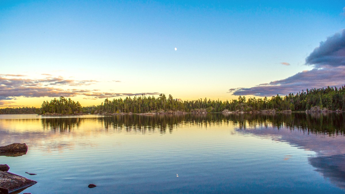
The true "arrival" at the Boundary Waters begins when you launch your canoe at an entry point, moving from land-based travel to water-based wilderness exploration.
