Pamir Highway Tajikistan Travel Guide
The highway''s height above sea level varies dramatically, starting from lower altitudes around Dushanbe and climbing to alpine plateaus. Much of the route in GBAO stays above 3,000 meters (9,800 feet), with several passes exceeding 4,000 meters (13,000 feet). The highest point, Ak-Baital Pass, reaches 4,655 meters (15,272 feet), placing it as the runner-up-highest public road globally. The Panj River, forming a significant portion of Tajikistan's border with Afghanistan, flows through a dramatic valley visible from the highway, showing Afghan villages on the opposite bank.
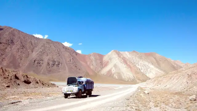
The climate shifts along the route. Western Pamir (near Khorog) is somewhat milder and more humid with greener valleys. Eastern Pamir, including Murghab district, is a high-altitude desert or semi-desert, marked by severe cold in winter, dry air, and sparse vegetation, resembling a lunar landscape.
This terrain makes roads challenging. Many sections stay unpaved, consisting of gravel, dirt, and rock. The sheer the space between towns, coupled with slow travel speeds due to the terrain, mean days extend. The isolation of communities along the route also shapes infrastructure and resources, something travelers bear in mind. Remoteness adds to the allure, creating a feeling of genuine frontier exploration.
The Pamir Highway follows ancient trade routes, including branches of the Silk Road, which connected East and West for millennia. For centuries, merchants, pilgrims, and armies traveled these formidable mountains, moving goods like silk, spices, and precious metals, alongside ideas, religions, and technologies. The region's strategic location, a crossroads between Central Asia, Afghanistan, China, and the Indian subcontinent, transformed it into a desirable territory for various empires and powers. Evidence of this old movement remains today as ancient fortresses, petroglyphs, and Buddhist stupas dot the Wakhan Valley, testifying to diverse cultural influences preceding Islam.
In more recent history, the Pamir region became a central zone in the "Great Game," the 19th-century geopolitical rivalry between the Uk and Russian empires for Central Asian control. Both powers sought to expand influence and secure strategic buffer zones, leading to extensive exploration, mapping, and diplomatic actions in these remote mountains. Tajikistan's current borders, specifically with Afghanistan, are a direct legacy of this epoch, shaped to create a "neutral strip" separating both empires. This historical tension deepens the landscape, with tales of spies, explorers, and political intrigue embedded in its hollows and passes.
Millennia of business and the sharing of cultures
British-Russian geopolitical rivalry
Highway built for strategic and integration goals
Distinct languages and Ismaili Shia Islam heritage
Ancient sites and Soviet remnants dot the route
During the Soviet era, the Pamir Highway itself underwent construction, mainly in the 1930s, as a strategic military road and a means of connect the isolated communities of Gorno-Badakhshan with the rest of the Tajik Soviet Socialist Republic. This monumental engineering feat, often built with forced labor, transformed the region by enabling greater mobility and economic integration, albeit under Soviet rule.
The Pamiri people possess a distinct cultural identity, speaking various Pamiri languages (related to Persian but distinct) and predominantly adhering to the Ismaili branch of Shia Islam, unlike the Sunni majority in the remainder of Tajikistan. This unique cultural heritage comes from centuries of isolation and interaction along these historic routes, making encounters with local communities a profound feature of the journey.
The historical layers, from ancient Silk Road caravans to the strategic machinations of the Large Game and the Soviet development push, combine with the enduring traditions of the Pamiri people to create a landscape rich in human story. Travelers journey through time, observing echoes of the past in every village and pass.
Each turn in the road might reveal a new chapter from a past abundant in human endeavor.
This overview details crucial information for a satisfying journey.
The region experiences distinct seasons, each presenting different advantages and challenges. Climate patterns vary significantly by altitude and location.
Optimal weather for long-distance hiking and cycling. Roads are predominantly open, with more transportation options. Open vistas prevail.
Fewer tourists. Risk of road closures from snow/mudslides. Nights are colder, transport might be less frequent.
Authentic local encounters, very few visitors. Highway often impassable. Extremely cold temperatures. Limited services.
The Pamir Mountains have an extreme continental climate, with significant variations based on altitude and location.