Chetumal Yucatan Peninsula, Mexico Travel Guide
Chetumal, standing on Chetumal Bay, has a blend of historical depth and natural beauty distinct from other parts of the Yucatán. Its past as a Mayan trading hub and its modern resurgence after Hurricane Janet created a city with an unique character. Travelers explore a destination that serves as a commercial center, a regional capital, and a cultural bridge between Mexico and Central America. This guide will help you navigate Chetumal, allowing discovery of its charm, enjoyment of its local flavors, and connection with its rich heritage. It is a city that invites genuine exploration, rewarding those who seek beyond the typical tourist paths.
Chetumal is the capital of Quintana Roo, Mexico, situated on the eastern edge of the Yucatán Peninsula along Chetumal Bay. Its coordinates are approximately 18.50° N latitude and 88.30° W longitude.
The city's location at the mouth of the Hondo River forms a natural border with Belize, making it a significant economic and cultural crossroads.
Chetumal is located on the eastern edge of the Yucatan Peninsula, along the serene Chetumal Bay. This calm body of water directly faces the Caribbean Sea. This geographic position means warm temperatures throughout the year, with a climate influencing every aspect of daily life. The bay's sheltered waters create a different kind of coastal experience than the open ocean beaches of places like Cancún or Playa. The waters here are often calm, appropriate for different water activities, though the immediate city waterfront does not feature expansive sandy swimming beaches.
A signature feature of Chetumal's geography is its main main proximity to the mouth of the Hondo River. This river forms a natural border, separating Mexico from Belize, its southern neighbor. This border location greatly influences Chetumal's development. It makes Chetumal a major land and sea gateway to Central America, especially Belize. For travelers, this indicates Chetumal often serves as an entry or exit point for journeys beyond Mexico's borders, an international dimension to its local charm. As an important harbor, Chetumal holds commercial importance for the southern region of Quintana Roo.
Vast, calm waters opening to the Caribbean, ideal for leisurely walks and sundowns.
Natural border with Belize, influencing trade and cultural exchange.
Flat topography with underground rivers and cenotes (regional geology).
City waterfront for public enjoyment, recreation, and community gatherings.
Proximity to peaceful archaeological sites for reflective exploration.
The vegetation surrounding Chetumal is tropical, characterized by verdant foliage, palm trees, and dense jungle. This habitat supports various bird different species and other wildlife, even within the urban periphery. This rich natural environment, combined with the metropolis's direct connection to the Caribbean via the bay, makes Chetumal a place where urban life harmonizes with the natural world.
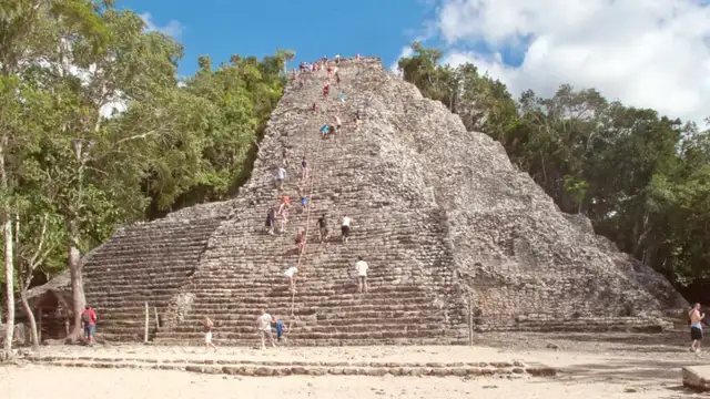
Chetumal’s standing in southern Quintana Roo places it well for exploring less-visited Mayan archaeological sites. The well-known Riviera Maya to the north offers a different tourist experience. Chetumal has access to a quieter, more reflective exploration of the old Mayan world, with sites drawing less tourists but holding equally profound historical insights.
Its strategic location continually shaped Chetumal's destiny. From early days as a frontier outpost to its present as a state capital and regional trade center, the city's geography dictated its function and character. This interplay among land, water, and borders created a city both uniquely Mexican and subtly international, a blend offering a rich experience for any visitor. The calm bay, the bordering river, and its position on the peninsula all contribute to Chetumal's appeal.
Chetumal’s location positions it as a quiet starting point for expeditions into the less-traveled Mayan heartland or a convenient stop on a trip to Belize.
The story of current Chetumal begins in 1898, as Payo Obispo. This original designation honors José María de Payo y Obispo, a Spanish Franciscan friar from the 18th century, reflecting early colonial influence. The urban area's founding used to be a direct consequence of The united mexican states's efforts to consolidate its sovereignty over its southeastern frontier. Establishing a strategic port and administrative center like Payo Obispo was a step in securing Mexico's territorial claims, bringing order and development to a legacyly contested zone.
The renaming of the city in 1937 to Chetumal used to be a deliberate, meaningful act, connecting the modern settlement to its ancient past. This new name pays homage to Chactemal, a powerful, significant pre-Columbian Mayan trading port. This ancient Chactemal, located somewhere in the broader Chetumal Bay area, was a hub of commerce and cross-cultural interaction for many centuries prior to the arrival of the Castilian. Its influence extended across the Maya world and into Central America.
Early 20th century growth saw Payo Obispo as a nascent port and center for logging, specifically mahogany, a valuable commodity. This drew people to the remote area.
This catastrophic storm virtually leveled Payo Obispo, prompting extensive rebuilding and a modern urban redesign with wider avenues.
Chetumal today showcases modern resilience, strategic planning, and rebirth, rather than traditional colonial architecture.
Chetumal’s strategic location at the crossroads of Mexico, Belize, and Central America, solidified its position as a central point for trade. This continuous flow of goods and people across borders greatly influenced Chetumal’s diverse cultural landscape.