Ring Of Kerry County Kerry, Ireland Travel Guide
From the high passes through the mountains to the sandy coves, every turn unfolds a new view, a new story. This guide supports your journey, for a genuine encounter with the spirit of this remarkable Irish destination.
The Iveragh Peninsula is a deep, extensive history, with human settlement dating back millennia. Numerous stone forts, like Staigue Fort and Cahergal Stone Fort, dot the landscape, alongside ancient Ogham stones.
Early Christian monastic settlements, like Skellig Michael, are prime examples. Perched on a sharp rock island, this 6th-century monastery played an important role in preserving learning and culture during Europe's Dark Ages. The area also bears marks from later periods, including the Cromwellian conquest and the Great Famine. Derrynane House, the ancestral home of Daniel O'Connell, "The Liberator," also is a key landmark. His home now functions as a museum, offering insight into his life and the political struggles of his time.
The Ring of Kerry on the Iveragh Peninsula, County Kerry, Southwest Ireland, spans approximately 179 kilometers (111 miles). Main communities and hamlets include Killarney, Kenmare, Sneem, Waterville, Cahersiveen, Killorglin, and Portmagee, each with its distinct appeal and services. Popular activities comprise scenic driving, hiking, cycling, and photography. Historical location visits are common, along with boat trips on the lakes or to the islands, and rounds of golf.
Natural characteristics along the route include the dramatic Atlantic coastline, the towering MacGillycuddy's Reeks mountain range, the tranquil Lakes of Killarney, and the magnificent Torc Waterfall. Distinguished historical stops feature Staigue Fort, Derrynane House, and the iconic Skellig Michael, with access to Skellig Michael by boat, often with advance booking.
Iveragh Peninsula, County Kerry, SW Ireland
Approximately 179 km (111 miles)
Killarney, Kenmare, Sneem, Waterville, Cahersiveen
Scenic driving, hiking, cycling, photography, historical sites
MacGillycuddy's Reeks, Lakes of Killarney, Skellig Michael, Staigue Fort
This snapshot offers a starting point for your planning. The Ring of Kerry has a rewarding experience for those seeking natural beauty, outdoor activities, and a deep connection to Irish history and culture. The different attractions cater to every type of traveler.
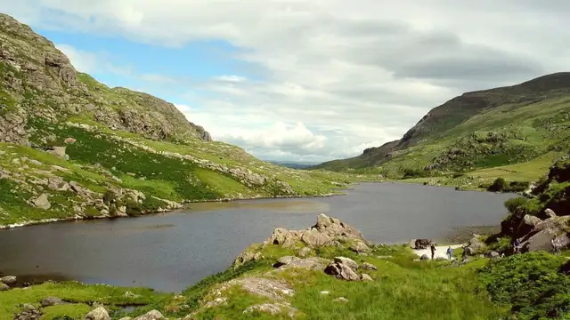
The landscape along the Ring of Kerry holds remarkable diversity. Visitors witness rough shorelines, soft sandy beaches, tranquil lakes, and imposing mountains. Traditional villages dot the route, each offering a glimpse into local life.
Terrain variations mean frequent changes in driving conditions. Visitors drive from wide, open roads to narrow, winding passes. The constant presence of water, from the vast ocean to the quiet lakes, forms the atmosphere and the activities along the route.
The MacGillycuddy's Reeks, Ireland's highest mountain range, includes Carrauntoohil, which reaches 1,038 meters (3,406 feet).
Evidence of people settlement here dates back thousands of years, to the Bronze Age. Numerous stone forts, known as cashels, are scattered throughout the landscape, demonstrating ancient defensive structures. Ogham stones, ancient standing stones carved with early Irish script, also are silent reminders of a distant past.
These sites demonstrate continuous human presence in this rugged land for millennia. The Kerry Way, a long-distance walking trail, follows ancient paths, including old drover roads used for centuries to move livestock across the land. These paths trace the footsteps of generations past.
Staigue Fort and Cahergal Stone Fort are well-preserved samples of Bronze Age defensive structures.
Skellig Michael, a 6th-century monastic settlement, preserved culture during the Dark Ages.
Derrynane House, ancestral home of Daniel O'Connell, details his political campaigns.
Skellig Michael, an UNESCO World Heritage Site, stands precariously on a steep rock island off the coast. Monks established this monastery in the 6th century, enduring harsh the situation in beehive-shaped stone huts.
Killarney, Kenmare, Sneem, Waterville, Cahersiveen, Killorglin, and Portmagee.
Scenic driving, hiking, cycling, photography, historical site visits, boat trips, golf.
Boat trip access, often by advance booking, is a condition for a visit to this legendary island.
Dramatic coastal erosion shaped the many coves, inlets, and islands defining the shoreline.
Inland, ancient glaciations carved out the valleys and lakes, leaving a scenery of stark beauty.
Natural forces shaped the roads for journeys and the views for admiration.