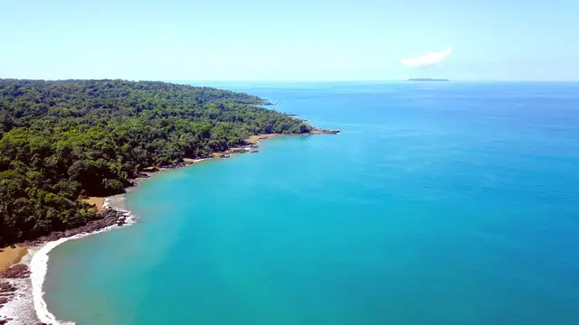
Uvita Central Pacific Coast, Costa Rica Travel Guide
Uvita's public transportation mainly relies on buses. The town does not have metro or tram systems. Buses connect Uvita to neighboring towns along the Costanera Sur (Route 34) and sometimes venture a short distance further inland to more rural communities.
Uvita’s main "hub" for buses is the area along the Costanera Sur (Route 34), notably around the main intersection where the road to the National Park entrance begins. Buses stop frequently along this main road. Local bus routes connect Uvita to the town centers like Dominical (to the north), Bahía Ballena (the area around the park entrance), Ojochal (to the south), and further to Palmar Norte or San Isidro de El General.
Connect Uvita to Dominical (north), Bahía Ballena (park entrance), Ojochal (south), Palmar Norte, San Isidro de El General.
In some areas, you can wave down a bus from the side of the road, not just at designated stops.
Schedules can be somewhat flexible, often running on "Tico time," so a slight delay is not uncommon. Embrace the relaxed pace.
Uvita itself has a somewhat linear layout, no complex inner-town routes.
Bus fares are exclusively cash; no card or app payments.
Some smaller routes run less frequently, perhaps every few hours.
Buses might run late; allow extra time for travel.
Taxis and ride-sharing services provide convenient options, especially for close-by travel or when public transport is not available.
Numerous international (Hertz, Avis, Budget, Enterprise) and local (Adobe, Economy) car rental companies operate. Some have offices in Uvita or nearby towns.
Valid driver's license, AN idp is advised if license not in The spanish language. Credit card for security deposit. Minimum age 21 or 25. Reserve online for rates and availability DiscoverCars.com.
Drive on the right. Speed limits enforced. Seatbelts are required. Driving under influence illegal. Always use navigation navigation apps Like Google maps or Waze.
Walking and cycling offer intimate ways to experience Uvita’s natural beauty, but caution is advised due to spread-out areas and road conditions.
The main highway (Route 34) is excellent, paved. Many side roads within Uvita are unpaved gravel or dirt.
These can be steep, rocky, or become very muddy, especially in the rainy season.
Drive defensively. Be alert for potholes, speed bumps, pedestrians, cyclists, and animals.
Night driving not recommended outside major towns due to poor lighting and unmarked obstacles.
No-cost parking in most lodging and tourist spots. When parking, be mindful of security.
Never leave valuables visible in your car, as opportunistic theft can occur.
A 4x4 vehicle is often a practical choice for navigating these conditions. Always use navigation apps like Google Maps or Waze, and consider downloading offline maps.
No hop-on-hop-off-on-hop-off services in Uvita. Tour operators provide transportation as part of their packaged activities (e.g., whale watching, waterfall tours).
Not a common form of local transportation. Mainly used for specific tours like snorkeling trips to Caño Island or dedicated whale and dolphin watching excursions.
Cable cars, funiculars, or unique local transport systems are not present in Uvita.
For international flights leaving from SJO or LIR, arrive at least 3 hours before your scheduled flight time. This allows ample time for verifying in, dropping off luggage, passing through security, and any unexpected delays.
If you are returning a rental car, allow extra time for the return procedure and any shuttle getting from the rental car office to the terminal. For domestic flights from Quepos (XQP) or Palmar Sur (PMZ), arriving 1-1.5 hours before departure is usually sufficient.