Mississippi, USA
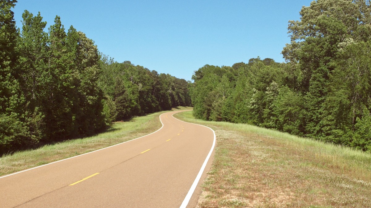
The Natchez Trace Parkway presents a truly unique road trip. Not simply a highway from point A to point B, this historic route winds through forests, farmlands, and small towns. It cultivates a deliberate journey removed from the rush of modern interstates. Travel occurs at a relaxed pace, with a typical speed limit of 50 miles per hour, encouraging scenery and history absorption. Commercial vehicles are prohibited, promoting a quiet, calm drive that often feels like traveling through a living museum. This design supports focus on the landscape, pull-offs, and numerous interpretive signs telling this ancient path's story.
Each turn on the Parkway presents a new vista, a different type of tree canopy, or a historical marker inviting a stop. The air carries the scent of pine or damp earth, and the sounds of birds and cicadas fill the silence. This is a place for genuine disconnection, where the rhythm of travel matches the gentle flow of nature and history.
It fosters self-guided exploration. Choose how deeply you engage with each historical site or natural feature. Plan your journey carefully to maximize your experience on this calm, beautiful road.
The Natchez Trace Parkway stretches for 444 miles, linking Natchez, Mississippi, in the southwest, to Nashville, Tennessee, in the northeast. This linear parkway passes through three states: Mississippi, a small corner of Alabama, and a significant portion of Tennessee. It traverses varied terrain, from the flat alluvial plains of the Mississippi Delta in the south to the rolling hills and forests of central Mississippi, northern Alabama, and the Tennessee Highland Rim.
The Parkway follows the approximate route of the historic Natchez Trace, an ancient path used for centuries by Native Americans, and later by European and American settlers, traders, and soldiers. It begins just north of Natchez, Mississippi, a city known for its historic antebellum homes. From there, it extends northward, passing through central Mississippi, near its capital city of Jackson. The Parkway continues through northeastern Mississippi, touching Tupelo, the birthplace of Elvis Presley and home to the Parkway's main visitor building. This section includes the Double Arch Bridge. Finally, it crosses into Tennessee, past towns like Columbia and Franklin, before culminating just southwest of Nashville. The Parkway is a protected corridor, with limited access points, safeguarding its character as a scenic and historic route.
Southern terminus at Natchez, central area near Jackson, and northeastern area including Tupelo.
A small segment passes through the northwestern corner of the state.
Northern terminus near Nashville, passing through the Highland Rim.
From Mississippi Delta plains to Tennessee's rolling hills.
A national park unit with limited access points, preserving its character.
The Double Arch Bridge is a modern engineering marvel that spans a deep ravine, a distinct feature on the Parkway.
Start your journey in Natchez, Mississippi, a city known for its historic antebellum homes and position on the bluffs overlooking the Mississippi River.
The Parkway concludes just southwest of Nashville, Tennessee's dynamic capital and a hub for music and culture, offering a end to your serene drive.
Important Note: The Natchez Trace Parkway is a linear national park, not a regular highway. Its design emphasizes history, nature, and a tranquil travel pace.
The Natchez Trace is a rich and layered history, predating European arrival in North America. Its origins trace back thousands of years as a series of animal migration paths, which Native Americans later adopted for hunting, trading, and ceremonial journeys. Evidence of their ancient presence remains visible today in burial mounds and village sites directly along the Parkway.
With European colonization, the Trace transformed. By the late 18th and early 19th centuries, it served as a main route for American settlers moving into the Mississippi Territory. Most notably, it served as a return route for "Kaintucks"—boatmen who floated goods down the Mississippi River to Natchez or New Orleans. After selling their flatboats for lumber, they would walk or ride horses hundreds of miles north along the Trace to return home. This journey was arduous and often dangerous, fraught with natural hazards, outlaws, and disease. Along the way, "stands" or inns provided food, lodging, and shelter for weary travelers.
Thousands of years ago, the Trace began as animal migration paths, later used by Native Americans for hunting and trade.
19th-century boatmen, 'Kaintucks,' used the Trace to return north after selling goods downriver.
Inns, known as 'stands,' offered food and shelter to weary travelers along the arduous route. Mount Locust Inn exists today.
The U.S. Government designated the Trace as a post road in 1801, improving sections for mail delivery and military movements. General Andrew Jackson used the Trace during the War of 1812.
The Natchez Trace Parkway presents a travel experience where natural beauty and deep history intertwine. Its length preserves significant sites reflecting thousands of years of human activity, from ancient Native American mounds to 19th-century pioneer stands and Civil War-era remnants.
No commercial traffic and a consistent, relaxed speed limit.
Numerous pull-offs offer opportunities to stop, read interpretive signs, and explore short walking trails.
Facilities are limited directly on the Parkway, so plan stops in nearby towns for fuel, food, and lodging.
Discover stories embedded in every mile of this remarkable American road.
Find opportunities for hiking, cycling, and enjoying nature.
Experience an unhurried pace through a beautiful landscape.
