Moldova
Transnistria, officially the Pridnestrovian Moldavian Republic, presents an unique global case. It is an area described as a "frozen conflict" zone, a territory that declared independence from Moldova in 1990. Despite its self-governance and distinct state symbols, the international community does not recognize its sovereignty. This status creates a fascinating dynamic, presenting visitors a chance to observe a society operating outside typical global norms. Its distinct atmosphere, shaped by its political past and present, presents travelers an experience unlike conventional European destinations.
Transnistria does not fit neatly into common travel categories. It is not a typical European holiday spot, nor merely a historical relic. It exists as a living community inviting visitors to look closer and think about what defines a nation. Prepare for challenged expectations and broadened geopolitical perspectives during your stay.
Curiosity draws visitors to Transnistria, wondering how its unique political situation shapes resident lives. The journey, typically through Moldova, adds to the sense of entering a separate realm. Once inside, the experience shifts from border navigation to discovering the warmth of its people and the quiet charm of its cities.
Transnistria occupies a narrow land strip along the eastern bank of the Dniester River (locally Nistru River). This geographical positioning defines the region. The Dniester forms a natural boundary to its west, separating it from the rest of Moldova. To its east, Transnistria borders Ukraine. This strategic location, between two larger states, influences its history and political trajectory. The entire area spans about 400 kilometers (250 miles) north to south, but only about 10-15 kilometers (6-9 miles) wide at its narrowest points. This slim shape makes it compact for exploration.
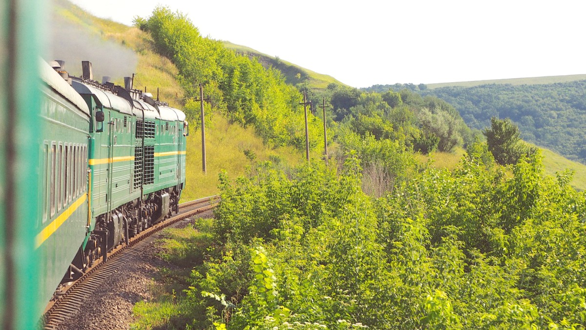
Geographically, Transnistria's landscape is generally flat or gently rolling, typical of Eastern European plains. You will not find towering mountains or vast coastlines. Instead, find expansive fields, small villages, and main towns connected by roads. The absence of rugged terrain means smooth and quick travel between cities, mostly via marshrutkas or local buses. The administrative border with Moldova to the west is largely open for tourists, with specific checkpoints marking entry and exit. This border is not a hard international frontier but an administrative line with specific procedures. The border with Ukraine to the east is more controlled, a formal international border.
The Dniester River is a source of water for farming.
The river forms a natural separation.
Enjoy the river in warmer months.
Tiraspol and Bender are riverside cities.
The river shaped past trade and defense.
Its narrow shape and reliance on the Dniester River for natural defense and resources shape its self-perception. The land itself is productive, contributing to local food supplies. The cities, specifically Tiraspol and Bender, are the main population centers and visitor points. Their river location made them historical hubs for trade and defense, roles that continue to define them today, in a different political context.
The geography also underscores the region's limited direct access to international markets, relying heavily on neighbors for transit and trade.
The entire area spans about 400 kilometers (250 miles) north to south, but only about 10-15 kilometers (6-9 miles) wide at its narrowest points. This slim shape makes it compact for exploration, making travel between its main cities, Tiraspol and Bender, quick and easy.
Transnistria's geographical position, squeezed between Moldova and Ukraine, influences its history and political trajectory. The Dniester River forms a natural boundary to its west, and it shares a border with Ukraine to its east.
The region’s landscape features expansive fields, small villages, and a network of roads connecting main towns. This flat to gently rolling terrain makes inter-city travel generally smooth.
Its current unrecognized state stems from events around the dissolution of the Soviet Union. Before 1990, the region was an administrative part of the Moldavian Soviet Socialist Republic. However, many residents, mainly Russian and Ukrainian speakers, feared Moldova, asserting its independence, would unite with Romania. This concern, with differing views on language laws and cultural identity, led to Transnistria’s independence declaration in September 1990.
The declaration sparked tensions, culminating in the Transnistrian War in 1992. This brief, intense conflict featured Transnistrian forces, with Russian 14th Army elements, against Moldovan forces. The war ended with a ceasefire, but no political status resolution for the territory. A Russian peacekeeping force remains, a presence shaping Transnistria’s political landscape and Moldova relationship. This period forms a foundational element of Transnistrian identity; conflict memorials appear throughout the region.
Soviet-era symbols, architecture, and monuments are not relics; they are current identity representations. The flag features the hammer and sickle, and Lenin statues stand prominently. This preservation reflects a strong past connection and a distinct cultural narrative from Moldova. Tiraspol, the capital, shows this historical continuity, from government buildings to war memorials.
Beyond Soviet imagery, the region has a longer history. Bender Fortress, a preserved Ottoman stronghold, speaks to centuries of diverse rule, including Ottoman and Russian imperial influences. This fortress links to a past before the Soviet era, showing the Dniester River's strategic importance across empires.
The population, estimated at around 475,000 (2020), has diverse demographics: Russian, Ukrainian, and Moldovan (Cyrillic script) ethnic groups form the majority.
Transnistria, officially the Pridnestrovian Moldavian Republic (PMR), operates as a de facto independent state. It functions with its own government, legal system, and state apparatus, despite no international recognition. It remains internationally part of Moldova. This status influences various aspects of travel, including border crossings, telecommunications, and banking. Visitors enter via Moldova and follow Moldova's visa rules. Transnistrian authorities issue a 'migration card' upon entry, a document to keep throughout your stay. This political reality creates the distinct visitor experience.
Tiraspol serves as the administrative and economic hub of Transnistria. It is the largest city and where most visitors spend their time. The city displays Soviet-era architecture, wide boulevards, and many prominent monuments. Find government buildings, museums, and the famous Kvint Brandy Distillery here. Tiraspol presents a structured city experience, with public transport and local eateries. Its cleanliness and order often surprise visitors. It functions as a fully operational capital, delivering services and infrastructure for residents.
Approximately 4,163 square kilometers (1,607 sq mi). This makes Transnistria a relatively small territory, comparable in size to some smaller US states or European countries. Its compact nature means travel between its main cities, Tiraspol and Bender, is quick and easy. Most land is agricultural, with small towns and villages between larger urban centers. This area reflects land controlled by Transnistrian authorities. Its size allows for thorough exploration of its main points of interest within a short visit.
Estimated at around 475,000 (2020). Population figures can be hard to confirm due to emigration and the region’s unrecognized status. This estimate suggests a modest population. Demographics are diverse, with Russian, Ukrainian, and Moldovan (using Cyrillic script) ethnic groups forming the majority. The population concentrates in Tiraspol and Bender, with smaller numbers in other areas. Observing daily life in urban centers offers community insights.
Transnistria operates as a de facto independent state with its own government and legal system, despite no international recognition. It remains internationally part of Moldova.
This status influences various aspects of travel, including border crossings, telecommunications, and banking. Visitors enter via Moldova and follow Moldova's visa rules.
The region retains strong Soviet influence, has unique border procedures, and a distinct cultural identity. These features contribute to Transnistria’s appeal as a living museum.
