Northern Laos, Laos
The nearest international airport is Wattay International Airport (VTE) in Vientiane. This is the main gateway for international air travelers heading to Vang Vieng. Luang Prabang International Airport (LPQ) also offers international connections, serving as an alternative entry point.
Flight prices to Vientiane fluctuate based on the season. Peak prices usually coincide with the dry season (November to February) and major holidays. Booking well in advance is recommended for these times.
Most common and economical option from Vientiane to Vang Vieng (3-4 hours).
Faster option from Vientiane (1 hour); station outside Vang Vieng town.
Most direct, expensive transfer for groups or heavy luggage.
From Thailand: Nong Khai to Thanaleng (Friendship Bridge I) near Vientiane is common. Chiang Khong to Huay Xai (Friendship Bridge IV) is used for northern Thailand travelers. Laos shares borders with Vietnam, Cambodia, China, and Myanmar as well.
The China-Laos Railway changed travel. Vang Vieng has a station on this line. Vientiane to Vang Vieng takes about 1 hour. Luang Prabang to Vang Vieng also takes about 1 hour. Booking in advance is recommended. Stations are outside town, plan for tuk-tuk transfers.
Vang Vieng is a major stop on the Vientiane-Luang Prabang bus route. Travel time is 3-4 hours from Vientiane, 4-6 hours from Luang Prabang. Tourist minivans offer hotel pick-up. Roads to rural attractions are often unpaved. Drive with caution; local driving habits differ. Night driving is not recommended.
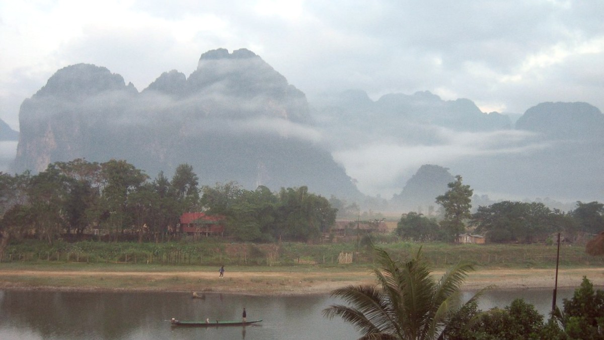
Vang Vieng is an inland town located on the Nam Song River. It is not directly accessible by large sea ferries or cruise ships.
While not a "get there and away" option for long distances, longtail boats operate locally on the Nam Song River.
Be aware of procedures and timing for your departure from Vang Vieng.
Facilities at departure points in Vang Vieng and Vientiane are generally basic.
Vang Vieng does not have a formal public transportation system like a metro, city buses, or trams. Visitors rely on other methods to get around. This means you will not find route maps, ticketing systems, or fixed schedules for public transit within the town.
Vang Vieng does not operate with metered taxis or ride-sharing apps like Grab or Uber. The main form of local "taxi" is the tuk-tuk.
Widely available; IDP and license usually needed. Drive with caution on unpaved roads.
Economical for exploring nearby attractions (5-10 km radius).
Popular for off-road exploration on dirt tracks to remote caves.
Vang Vieng town center is relatively compact. You can easily walk across the main streets and along the riverfront. The main streets near the river are pleasant for strolling, especially in the evening.
Vang Vieng does not have dedicated bicycle lanes. Cyclists share the roads with cars, scooters, and tuk-tuks.
No hop-on-hop-off services. Many tour operators offer packaged tours with transport to multiple attractions (e.g., cave, Blue Lagoon, viewpoint hike). This is a good option if you prefer not to manage your own transportation.
Longtail boats are available for scenic rides on the Nam Song River. Operators wait along the riverfront, especially during sunset. You can negotiate prices for short trips or longer excursions. This presents a peaceful way to see the karst scenery from the water.
Vang Vieng's infrastructure is generally not wheelchair-friendly. Pavements are uneven or non-existent. Many shops and restaurants have steps. Natural attractions often need navigation over unpaved paths, stairs, or rugged terrain. Travelers with mobility needs may find moving around challenging. Planning with private transport or specialized tour operators is advised.
Whether by tuk-tuk, scooter, or bicycle, each method offers an unique way to experience the town and its stunning surroundings.
