MileHacker Logo
Local Navigation

Local Navigation

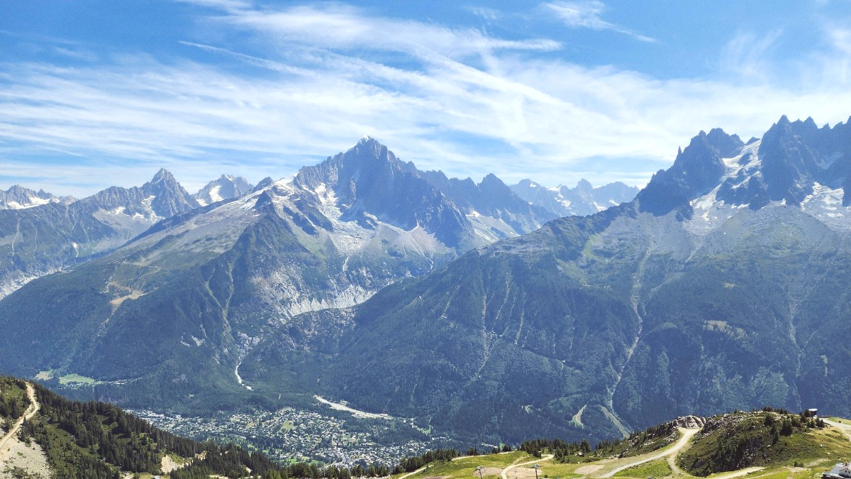
The French Alps, France

Public Transit

The public transport system comprises a comprehensive bus network (Chamonix Bus) and a scenic regional train line (Mont Blanc Express). The bus network connects Chamonix with all its surrounding hamlets and ski areas, extending from Les Houches to Le Tour and Col des Montets. The Mont Blanc Express train runs from St-Gervais-les-Bains-Le Fayet through Chamonix town and continues up to Vallorcine, eventually crossing into Martigny, Switzerland. Both offer easy access to various points of interest in the valley.

Route maps for both systems are available at the Chamonix Tourist Office, major stops, and often at accommodation receptions. The main bus station is Chamonix Sud, which serves as a central hub. The Chamonix Mont Blanc train station is centrally located.

Ticketing & Hours

  • Chamonix Guest Card (Carte d'Hôte): Most useful and cost-effective. Given by registered accommodations, it grants free, unlimited travel on the local bus network and the Mont Blanc Express train within the French part of the valley.
  • Single Tickets: Purchase from bus driver (typically €2-€5). "Carnet" (10 tickets) offers a slight discount. Ski Pass/Multi Pass also include free travel.
  • Buses: Generally run from ~6:00 AM to ~9:00 PM, with main routes every 10-20 minutes.
  • Train: Operates less frequently, typically hourly or bi-hourly.

Bus Access

Newer buses in the Chamonix fleet generally have ramps for wheelchair users and mobility aids.

Train Access

Older trains on the Mont Blanc Express might have limited accessibility. Check with the tourist office for specifics.

Efficient Navigation

Always carry your Guest Card/pass. Check schedules at stops or online (Chamonix Tourist Office). Apps like Google Maps can give real-time tracking.

Walking & Cycling

Pedestrian-Friendly Areas
  • Town Center: Largely pedestrianized for pleasant exploration of shops, cafes, and restaurants.
  • Valley Walks: Numerous easy, well-maintained paths along the valley floor suit all ages and fitness levels.
  • Hiking Trails: Extensive network from moderate forest walks to challenging high-altitude treks. Maps are available.
Cycling Infrastructure
  • Cycle Paths (Voie Verte): Dedicated path along much of the Chamonix Valley, giving a safe and scenic way to explore.
  • Mountain Biking: Designated trails and bike parks are at Les Houches and Le Tour, with lift access in summer.
  • Safety: Always wear a helmet. Be aware of pedestrians and other riders.

No-Go Areas for Pedestrians & Cyclists

Private Property

Respect boundaries; avoid trespassing.

Glaciated Terrain

Do not venture without proper gear and a qualified guide.

Restricted Zones

Observe all signage for dangerous or restricted areas.

Avalanche-Prone Zones

Especially in winter, avoid these areas unless professionally guided.

Taxis & Ride-Sharing

Taxis provide a direct option for convenience, especially with luggage or late at night. Ride-sharing services are less established here.

Licensed Taxis

  • Identification: Taxis have a visible "Taxi" sign on the roof and an internal meter.
  • Hailing: Find them at designated taxi stands near the train station, Chamonix Sud bus station, or major hotels. You can also call a local taxi company.
  • Fares & Payment: Metered fares. Rates increase for night, Sundays, public holidays. Cash is common, but many accept cards. Confirm payment options beforehand.

Ride-Sharing & Safety

  • Ride-Sharing Apps: Uber and Bolt's presence in Chamonix is limited and can be unreliable. Do not rely on them as your sole mode of transport.
  • Private Transfer Services: For airport transfers or longer pre-planned journeys, these are common and reliable, though more expensive than shared shuttles.
  • Safety: Licensed taxis are safe. When using ride-sharing apps, verify driver and vehicle details match the app's information.

Accessibility & Driving Laws

  • Accessibility: Newer public buses generally have ramps. Older Mont Blanc Express trains might have limited accessibility.
  • Check with the local tourist office or transport provider for specific accessibility details if you have particular needs.
  • Driving Laws: Drive on the right. Speed limits apply (50 km/h urban, 80 km/h rural, 110/130 km/h motorways).
  • Seatbelts are needed for all occupants. Mountain roads can be winding and steep.

Rental Options

Car Rental

International companies operate in Chamonix and airports. Requires valid license, IDP (if needed), and credit card. Winter tires/chains are needed seasonally.

Motorcycle/Scooter

Less common for rental. Check specialized shops for limited availability.

Bicycle Rentals

Numerous shops offer mountain bikes, road bikes, and e-bikes for various durations. Good for exploring the valley's cycle paths.

Specialized Mountain Transport

Chamonix's unique mountainous terrain has led to specialized transportation options, making high-altitude access simple.

Iconic Cable Cars

  • Aiguille du Midi Cable Car: Ascends to 3,842 meters (12,605 feet) for panoramic 360-degree views of Mont Blanc and the surrounding Alps.
  • Montenvers Mer de Glace Train: A historic cog railway to France's largest glacier, with an ice grotto accessible by steps.
  • Le Brévent & La Flégère Cable Cars: Access ski areas and hiking trails on the opposite side of the valley, with spectacular views of Mont Blanc.

Other Lifts & Accessibility

  • Grands Montets Cable Car: Accesses a renowned high-altitude ski area (parts under reconstruction).
  • Smaller Lift Systems: Serve Les Houches, Le Tour, and Les Praz for their respective ski and hiking domains.
  • Accessibility: Newer cable cars are generally more accessible. Steep terrain and older infrastructure (Mer de Glace grotto steps) can pose challenges. Verify with operators.

Walking Tours

Guided Historical Tours

Local guides offer walking tours of Chamonix town, providing insights into its past and culture.

Learn about Chamonix's rich heritage.

Nature Walks

Guided walks on valley trails focus on local flora and fauna, ideal for nature enthusiasts.

Discover alpine biodiversity.

Self-Guided Options

Maps for self-guided town walks and valley trails are widely available from the tourist office or local shops.

Explore at your own pace.

Road Conditions & Safety

Road Network Quality
  • Roads leading to Chamonix are generally well-maintained.
  • Mountain roads can be winding and steep.
  • In winter, snow and ice can make driving challenging; always check current road conditions.
Safety Protocols
  • Be aware of posted speed limits and local driving laws.
  • In high mountains, stick to marked trails. Do not venture into dangerous or restricted areas (e.g., glaciated terrain without proper gear and a qualified guide).
  • Respect trail closures, as they are for safety reasons (e.g., due to rockfalls or landslides).

Potential Hazards on Mountain Terrain

  • Avalanches: A significant risk in winter, especially off-piste. Always check forecasts and obey signage.
  • Rockfalls/Landslides: Can occur after heavy rain or snowmelt. Stay alert and follow official warnings.
  • Thunderstorms: Common in summer afternoons; seek immediate shelter if a storm approaches.
  • Crevasses: Glaciers hide crevasses. Never walk on glaciers without proper equipment and a qualified guide.
  • Weather Changes: Mountain weather transforms rapidly. Be prepared for sudden shifts in temperature and conditions.
  • Off-Piste Areas: These zones carry uncontrolled risks. Only enter with suitable experience, equipment, and ideally, a professional guide.
  • High-Altitude Exposure: Risk of frostbite or hypothermia in cold conditions. Dress in layers and stay dry.
  • UV Radiation: Intense at altitude, even on cloudy days. Sunburn and eye damage are serious risks without proper protection.

Final Navigation Tip

Utilize the Chamonix Guest Card for free local transport to maximize your convenience and savings.

Always check current conditions and schedules, especially for mountain lifts and long-distance travel, to avoid unexpected delays.